Iceland's South Coast is where the country's landscape choreography reaches a crescendo. In a single drive along Route 1, the terrain shifts from waterfalls to black sand beaches to glacier views to otherworldly volcanic plains. More tourists visit this region than anywhere else in Iceland except Reykjavík—and unlike many touristed places, this one actually deserves the attention. The geography is legitimately extraordinary.
The South Coast rewards both rushed visitors (you can hit the main spots in 8 hours) and leisurely travelers (two days reveals dimensions most people miss). This guide covers the major attractions, the geology that makes them significant, practical logistics, timing strategies to avoid crowds, and the quieter angles that transform a tourist experience into something personal.
Drive east from Reykjavík on Route 1. Hit Seljalandsfoss (waterfall you walk behind), then Skógafoss (massive waterfall), then continue to Reynisfjara (black sand beach near Vík). That's the classic itinerary—about 8–10 hours from Reykjavík including stops. From there, the landscape becomes wilder and less touristy: glacier views, black sand plains, basalt formations. Most visitors stop at Vík. Going further east toward Jökulsárlón (glacier lagoon) adds 3–4 hours but reveals what the South Coast becomes away from peak tourist zones.
Seljalandsfoss: The Waterfall You Walk Behind
The Geology and Water Source
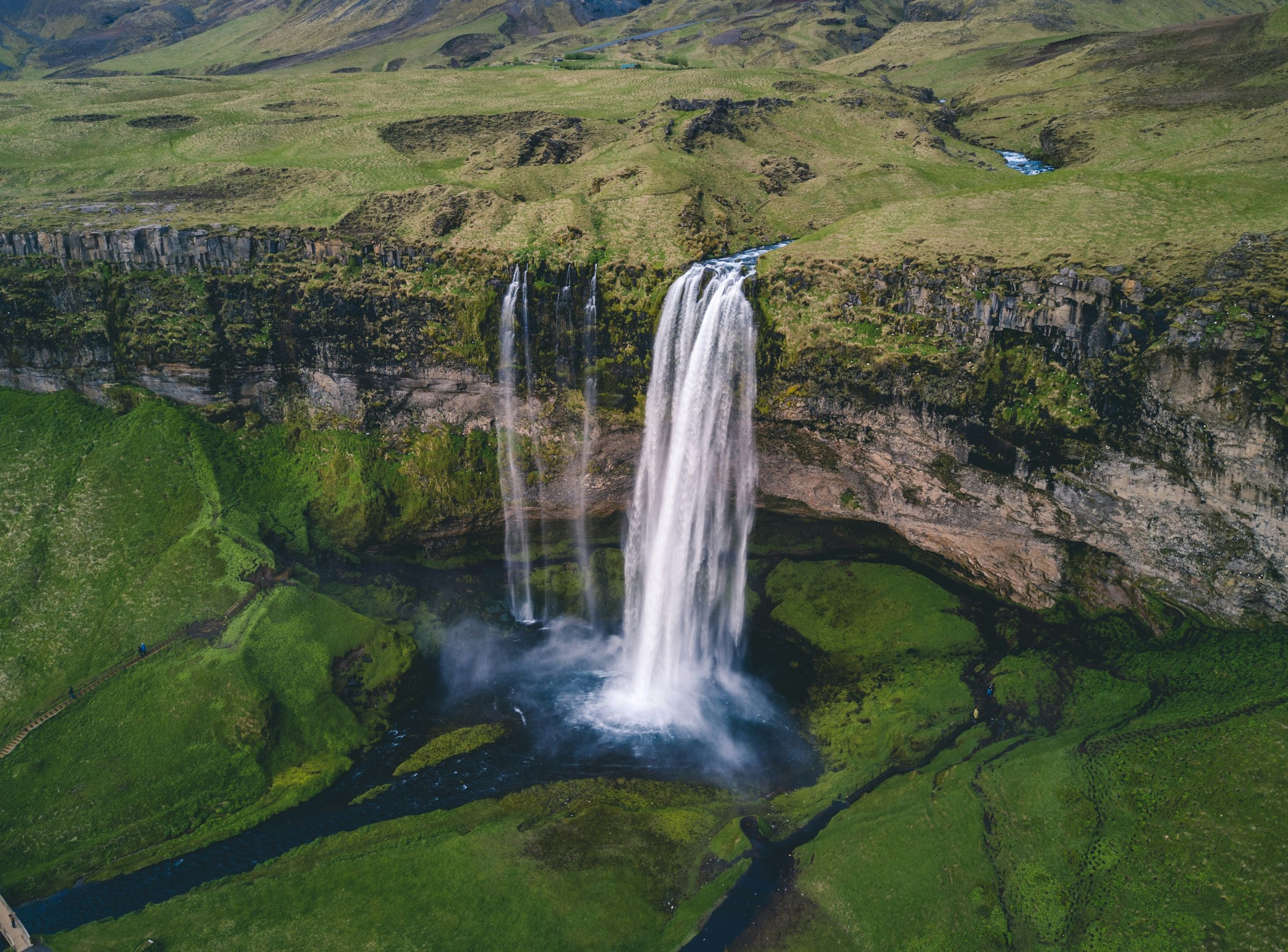
Seljalandsfoss is fed by the Seljalands River, which originates from Eyjafjallajökull, one of Iceland's active volcanoes. The water drops about 60 meters into a plunge pool below. What makes Seljalandsfoss unique isn't just the height—it's the geology. The rock formation creates a void behind the falls, allowing a trail to loop behind the water curtain. This is a rare geological arrangement; most waterfalls don't allow such access.
The Walk Behind the Falls: What to Expect
The walk behind Seljalandsfoss takes about 15 minutes round-trip. The reason people remember it is simple: you are walking behind falling water, and the spray often soaks you completely. Summer brings higher water volume from glacial melt. Winter has lower volume, but ice can make the path dangerous.
Practical reality: You will be soaked. Waterproof gear is essential—a waterproof jacket isn't sufficient; you need waterproof trousers too. Bring dry clothes for the drive afterward. The rock is incredibly slippery; proper hiking boots with excellent grip are non-negotiable. The trail is short but physically demanding because of the treacherous footing.
Gljúfrafoss: The Hidden Waterfall Across the Road
While you're at Seljalandsfoss, across Route 1 there's a second waterfall called Gljúfrafoss that drops into a hidden cave-like canyon. It's less famous than Seljalandsfoss and sees perhaps one-third the traffic. The walk takes about 5 minutes. The setting is moody and dramatic—the water drops into a narrow gorge with steep basalt walls. If you have 15 extra minutes, Gljúfrafoss is worth seeing. It offers a different perspective on Icelandic waterfalls.
Parking Strategy and Timing
Seljalandsfoss now has a proper paid car park. It's not enormous—perhaps 300 vehicles—and fills by 10 AM in summer. Overflow parking is available but farther away. Arrive before 9 AM to get a main lot spot. If you're visiting on a tight schedule and main parking is full, consider the overflow or returning later in the afternoon (after 4 PM, when tour buses have departed).
Skógafoss: Iceland's Most Powerful Waterfall
The Scale and Power
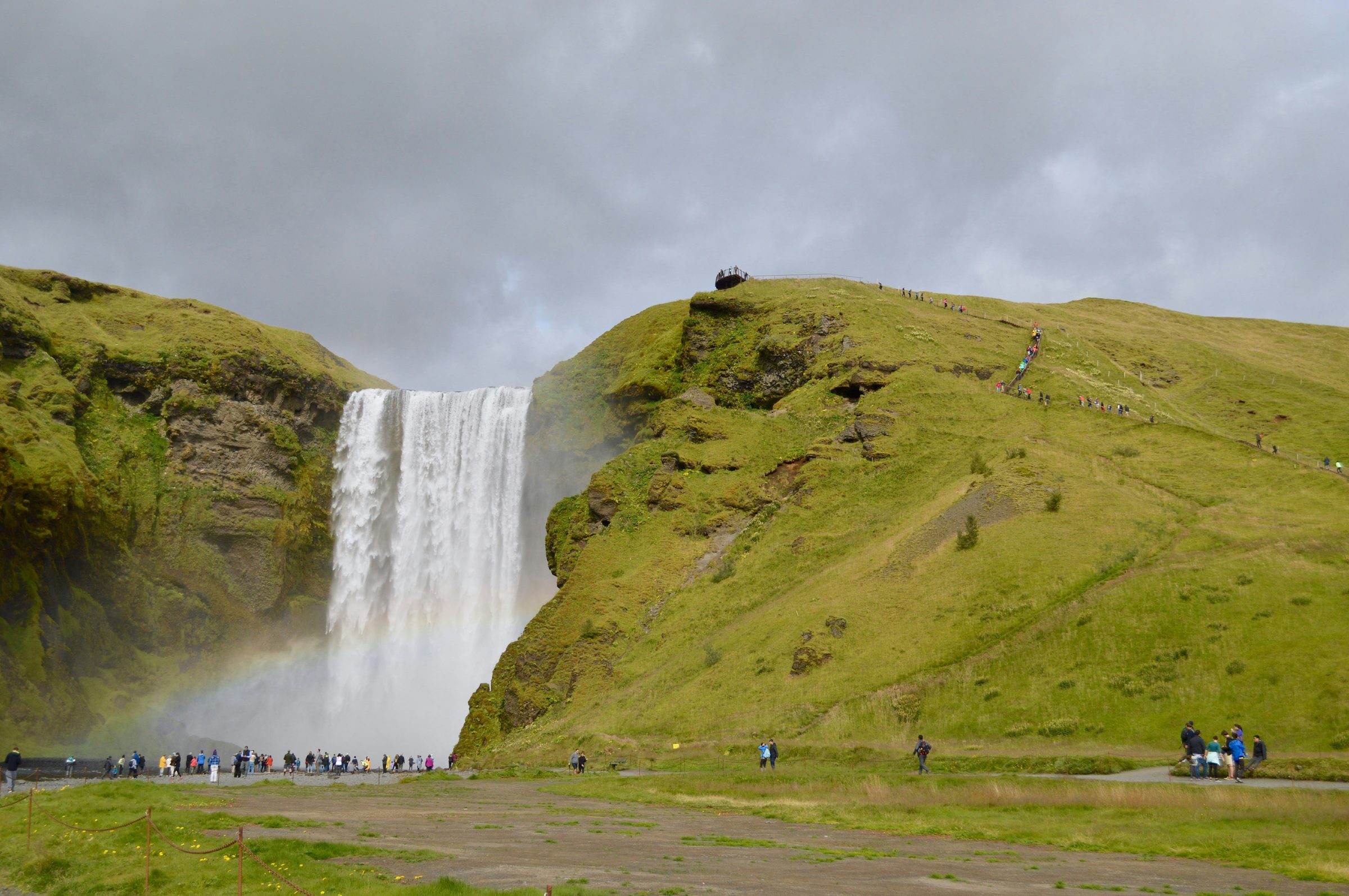
If Seljalandsfoss is elegant, Skógafoss is brutal. It drops about 60 meters (same as Seljalandsfoss) but with far greater volume. The Skógá River feeding it originates from the highlands and carries immense water volume, particularly in summer. The roar is physical—you hear it before you see it. The mist rises so high that on clear days you can see rainbows from the viewing platform.
Standing at the main viewing area, you understand why Icelanders view waterfalls as sacred—the sheer power is humbling. It's not a graceful fall; it's an overwhelming force of water and gravity.
The Climb to the Top: The Skógafoss Trek
A steep trail climbs alongside the waterfall to the top. It's about 45 minutes of elevation gain (not for people with knee issues). The trail is muddy, eroded in places, and unforgiving in wet conditions. However, reaching the top offers a perspective most visitors miss: you see the river disappearing over the edge, the landscape extending to the coast, and the scale of the geography becomes apparent. On clear days, you can see from the South Coast all the way to the mountains.
The descent is harder than the ascent—controlling your footing on a muddy steep descent requires focus. Many visitors who climb it regret the decision on the way down. It's worth doing, but understand it's serious hiking, not a casual walk.
Photography at Skógafoss
Skógafoss is supremely photogenic. The challenge is that the main viewing platform is at a standard angle, and it gets crowded. For unique photos: (1) Go early (7–8 AM) when light is golden and crowds are absent. (2) Go late (5+ PM) when tour buses have left. (3) Do the climb to the top for a completely different angle. (4) Shoot in overcast conditions when the landscape is moody and colors are richer. Bright sun on white mist can blow out phone camera exposure—you often get better results on cloudy days.
Parking and Crowds
Skógafoss has a large paid car park that's better organized than Seljalandsfoss. However, it still fills in summer. Same strategy: arrive early or go late. Peak tourist time is 10 AM–3 PM.
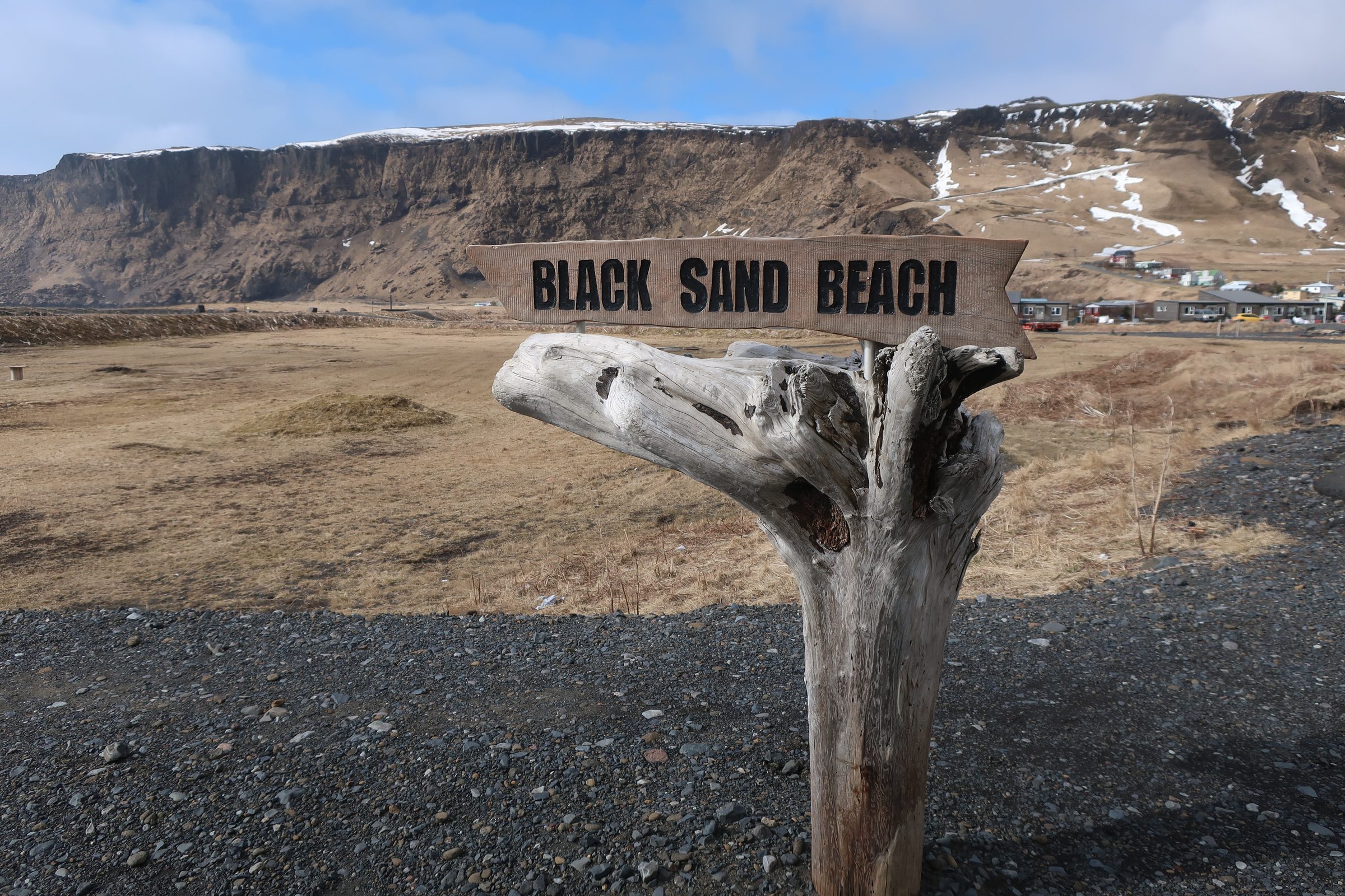
Reynisfjara: Black Sand Beach Like Nowhere Else
The Geology: Why Black Sand?
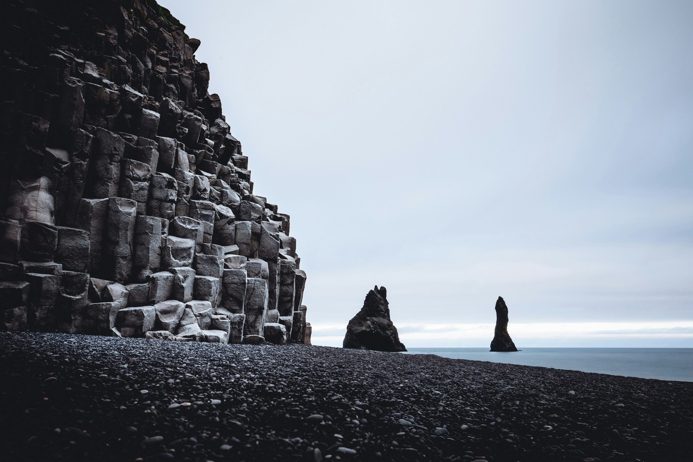
Reynisfjara's "sand" is actually fine volcanic basalt—a consequence of Iceland's volcanic geology. The island is built from lava flows and volcanic deposits. When lava flows reach the ocean, they cool rapidly and fragment into particles. Over millennia, wave action has pulverized these volcanic rocks into sand. The black color is iron oxide and magnetite from the basalt.
This sand is harder and coarser than tropical sand—it feels more like gravel. It doesn't stick to skin the way tropical sand does. But walking barefoot on it is uncomfortable; it's like walking on fine gravel.
Basalt Formations and Columnar Jointing
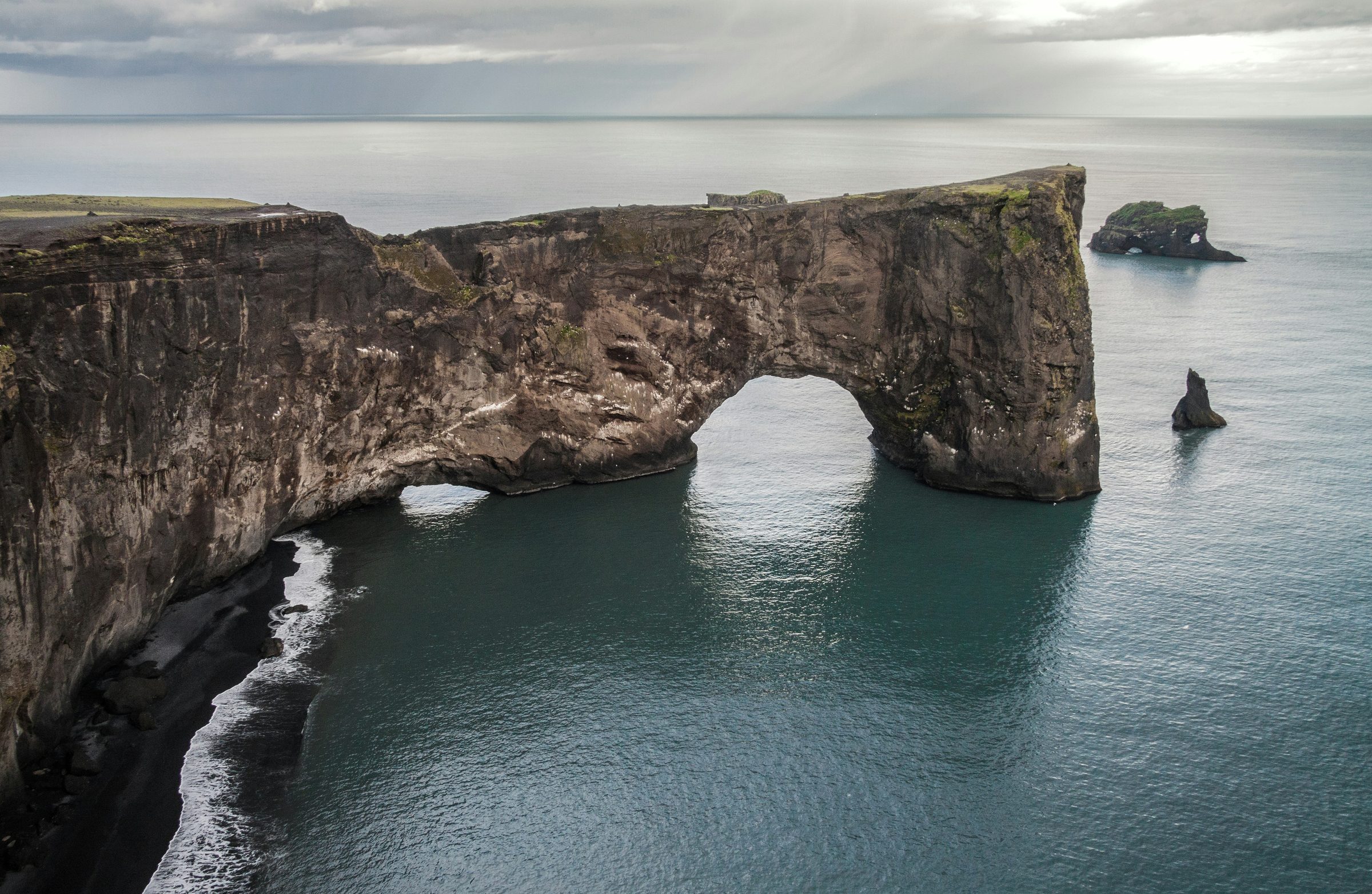
Beyond the sand, Reynisfjara has dramatic basalt columns (Reynisdrangar) rising from the ocean. These are former sea stacks created by wave erosion over millennia. The hexagonal columnar structure is the result of how basalt cools—the cooling process creates stress patterns that form hexagonal columns. You see this structure throughout Iceland but it's particularly visible here.
The Ocean: Beautiful and Deadly
Reynisfjara's ocean is not a swimming beach. The waves are violent and unpredictable. The water is freezing (5–8°C even in summer). The undertow is serious. Every year, tourists die trying to get closer to the water for photos. The Icelandic rescue teams refer to Reynisfjara as one of their most frequent call-out locations for people in trouble.
Waves at Reynisfjara come without warning and pull people in. Every year tourists die here. Stay on dry sand, never approach the wet edge, and keep watching the water — not your camera. No photo is worth it.
The beach is safe if you respect the water. Stay on the dry sand. Don't approach the wet sand edge. Watch the water, not your camera. Most visitors experience it fine because they're sensible. A few each year don't survive because they weren't.
The Village of Vík: Worth More Than a Fuel Stop
Most tourists treat Vík as a waypoint—drive through, see the beach, move on. The village itself has character and local amenities that the main tourist zones lack. If you have time, spend an hour in Vík. There are decent restaurants, a small church (Víkurkirkja) with views, and a local culture that reveals how Icelanders actually live away from tourist infrastructure.
Parking at Reynisfjara
Park in Vík village (free parking available). The beach is a 10–15 minute walk away. This prevents overcrowding at the beach itself.
Beyond Vík: The Wilder South Coast
The Landscape Transformation
East of Vík, Route 1 enters a region that feels fundamentally different. The landscape becomes blacker—more volcanic. Fewer people stop here. Glacier views dominate. The roads are still good but feel more remote. This is where the South Coast transitions from a tourist circuit to actual Icelandic wilderness.
Skaftafell: Gateway to the Highlands
Skaftafell is the most popular hiking area in Vatnajökull National Park. The main trails include Svartifoss (black waterfall surrounded by basalt columns), a landscape that's visually striking. The trail is about 2 hours round-trip and well-maintained. However, Svartifoss is popular—if you want solitude, go early (7 AM) or choose less-famous trails in the same area.
The area offers multiple trail options ranging from easy to challenging. If you have hiking interest, Skaftafell deserves significant time. Most tourists rush through; hikers often spend a full day here.
The Black Sand Plains
Between Vík and Skaftafell, Route 1 crosses black sand plains with minimal vegetation. The landscape feels Mars-like. These areas are geologically recent (in geological terms)—lava flows from the last thousand years that haven't yet developed soil or vegetation. The contrast with the green vegetation of western Iceland is striking. This landscape is what early Iceland looked like before plant life stabilized the terrain.
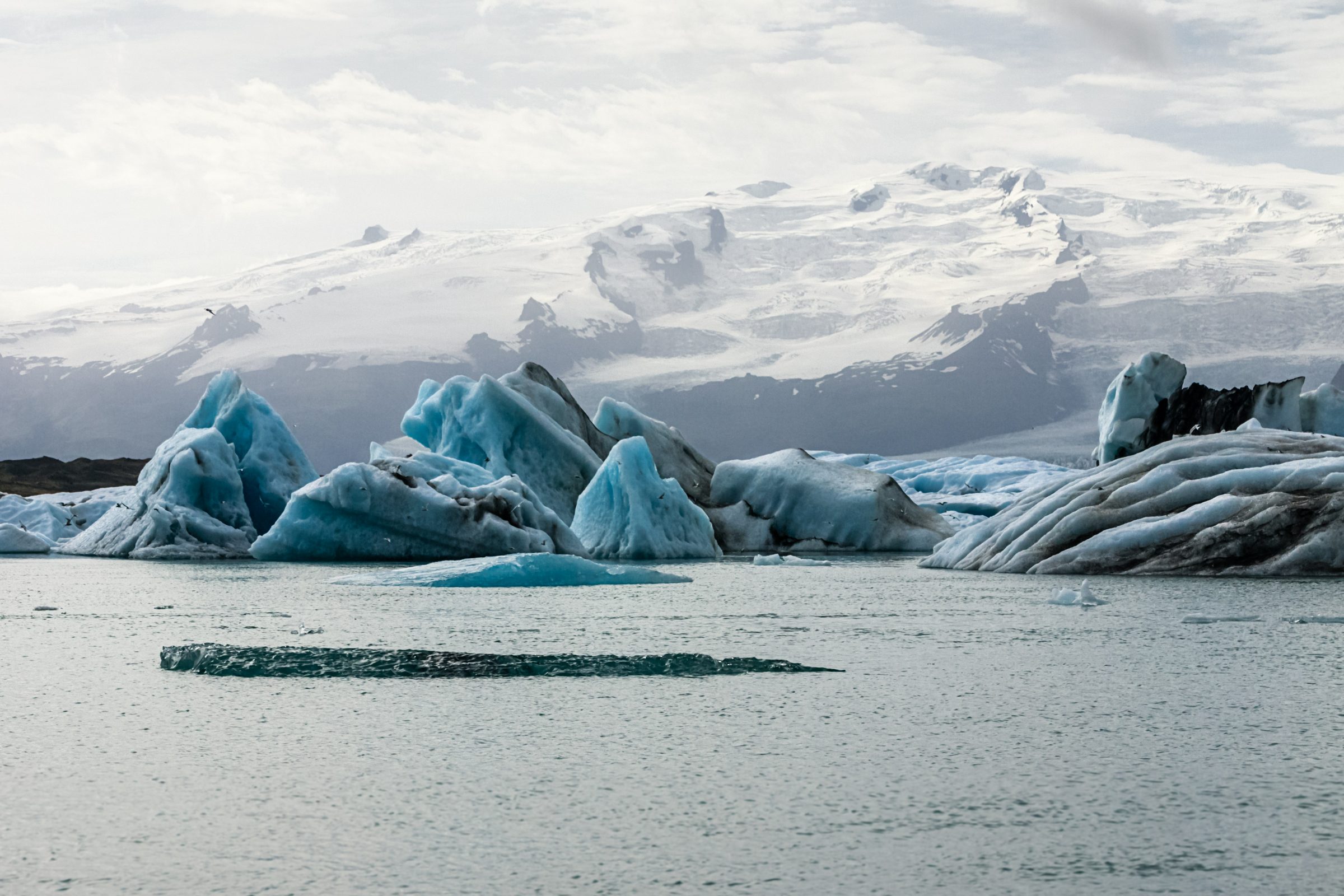
Glacier Views: Mýrdalsjökull and Öræfi
Throughout this region, you have views of major glaciers. Mýrdalsjökull (the glacier under which Katla volcano sits) dominates the western section. Further east, Öræfi glacier is visible. These aren't just aesthetic features—they're active geological forces. Mýrdalsjökull has subglacial volcanic activity. The glacier is actively retreating. These are dynamic landscapes, not static scenery.
Practical Information
Route Planning: Day Trip vs. Multi-Day
Day trip (8–10 hours): Seljalandsfoss, Skógafoss, Reynisfjara, return to Reykjavík. Doable but rushed.
Two-day trip (recommended): Day one: Seljalandsfoss, Skógafoss, sleep in Vík. Day two: Reynisfjara, Skaftafell, explore beyond Vík, return to Reykjavík or continue east. This pacing lets you explore rather than sprint.
Three-day trip (best): Day one: Waterfalls. Day two: Reynisfjara and Vík area. Day three: Skaftafell, glacier views, Vatnajökull exploration. This is realistic pacing.
Driving Conditions and Safety
Route 1 is paved and maintained throughout. It's straightforward driving in summer. Winter conditions vary—check road reports. Wind can be fierce on exposed sections. The weather can change rapidly; don't be surprised by sudden rain or wind gusts.
Accommodation Options
Vík: Small town with hotels, guesthouses, and campsites. Good base for South Coast exploration.
Between stops: Small villages have accommodation but limited options. Book ahead in summer.
Camping: Established campsites exist throughout the region. Wild camping requires written permission from landowners and is best avoided—use official campsites instead.
What to Bring: Complete Packing
Season-by-Season Guide
May and September: Ideal balance. Weather is decent, crowds manageable, light excellent. May has higher water volume (snowmelt) making waterfalls more dramatic. September has autumn colors beginning.
June–August: Peak summer. Best weather, longest daylight. Busiest with tourists. Parking lots fill. Trails are crowded. Worth experiencing if that's when you're here.
October–April: Weather is harsh and daylight is limited. The reward is fewer tourists, low winter light, and sometimes snow on the black sand and cliffs. The tradeoff is real: wind, ice, road closures and short sightseeing windows. Winter requires serious preparation.
What Most Guides Miss
The Smaller Waterfalls Nobody Photographs
Between major stops, Route 1 passes several smaller waterfalls visible from the road—some with small pullouts, others visible from the highway. Hraunfossar and Barnafoss (west of Seljalandsfoss) are beautiful and virtually empty compared to the famous falls. If you're interested in waterfalls specifically, exploring these lesser-known ones reveals how common waterfalls are in Iceland.
Timing Light for Photography
The South Coast faces north. Best light is late afternoon (4–6 PM) when the sun is lower and warmer. Midday light is harsh and unflattering. Overcast conditions often produce better colors than bright sun. If photography is your focus, plan your timing around light, not crowds.
The Road East of Vík: Few People Go
Most tourists stop at Vík and return toward Reykjavík. If you continue east toward Skaftafell and beyond, you enter a region with far fewer tourists. The landscape remains dramatic. Hiking opportunities improve. The experience shifts from "tourist circuit" to "actual Icelandic travel." Most visitors miss this entirely.
Local Culture in Vík
Vík has restaurants and local businesses that serve residents as well as visitors. Spend a little time there and you see a different side of the South Coast: a small working village dealing with weather, distance, tourism pressure and everyday rural life.
The Bottom Line
The South Coast is crowded because it's genuinely spectacular. Multiple waterfalls, a black sand beach that looks alien, glacier views, and a landscape that shifts dramatically—it's a lot in one region. The crowds are real, but the landscape rewards spending time here despite the tourism.
Allocate at least two days if possible. Visit waterfalls in early morning or late afternoon to avoid peak crowds. Respect the ocean at Reynisfjara. And if you have time, venture east of Vík where the landscape becomes wilder and fewer tourists venture.
The South Coast isn't subtle or hidden. But it doesn't need to be. It's genuinely one of Iceland's best road trips, crowd-heavy or not.