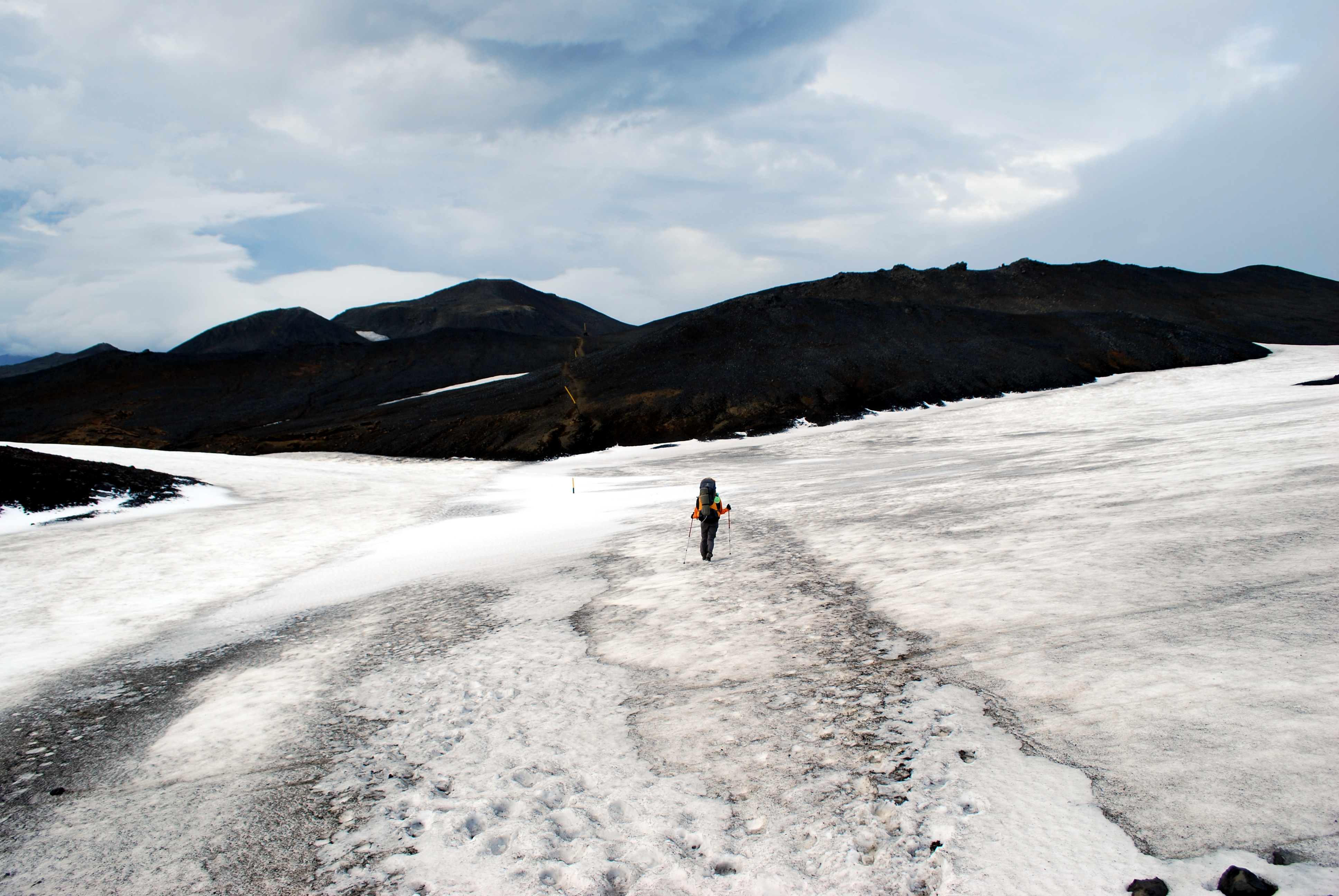
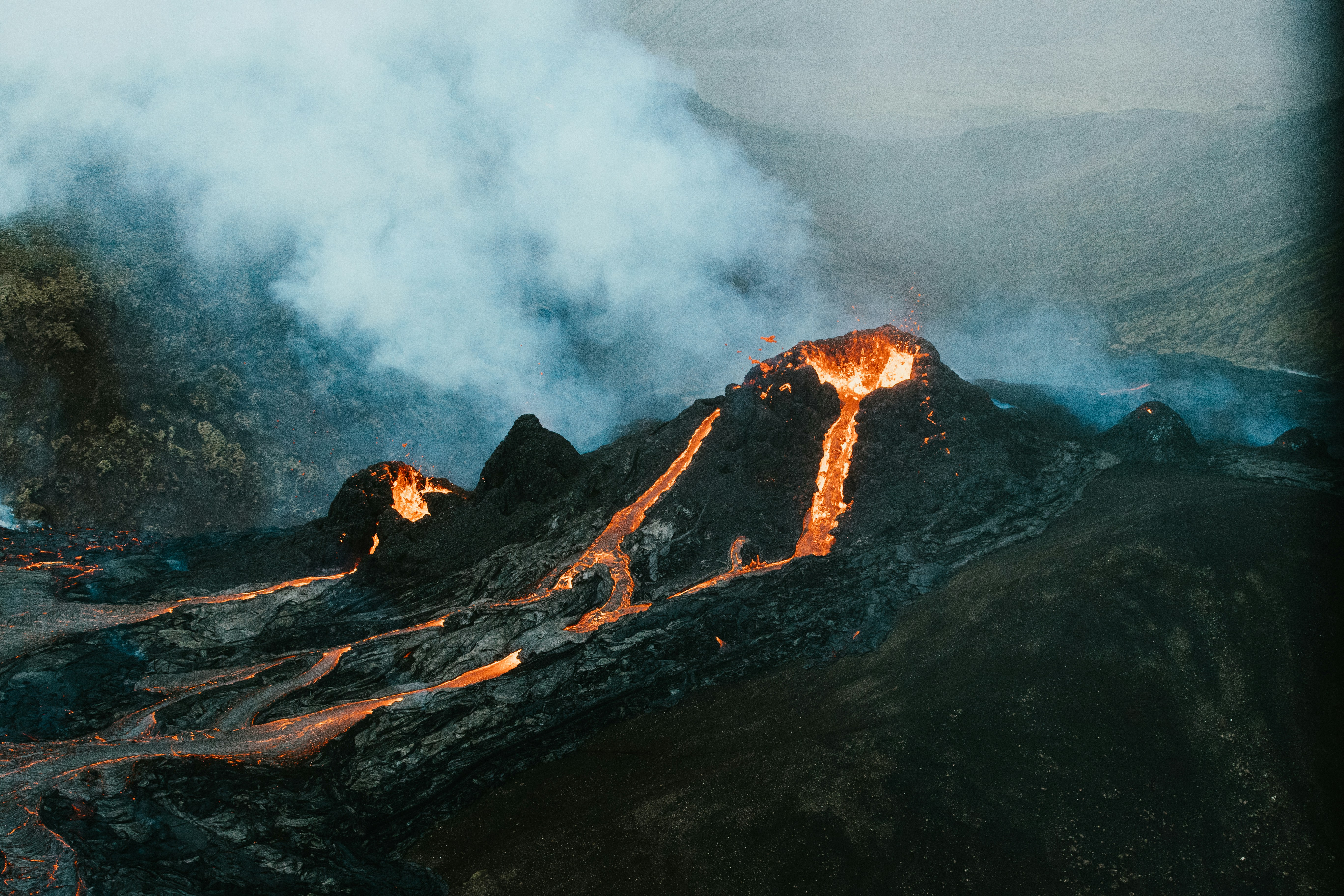
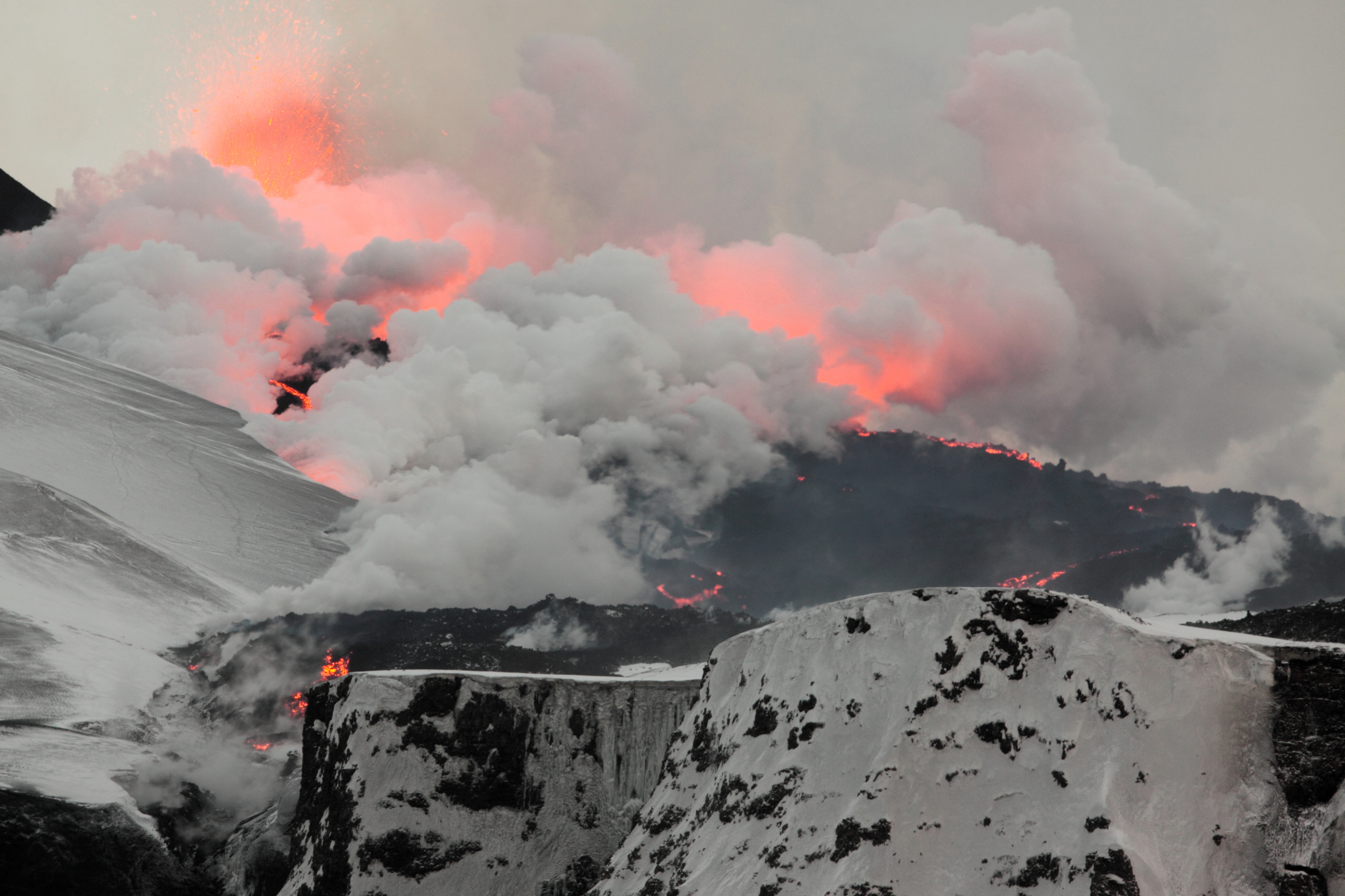
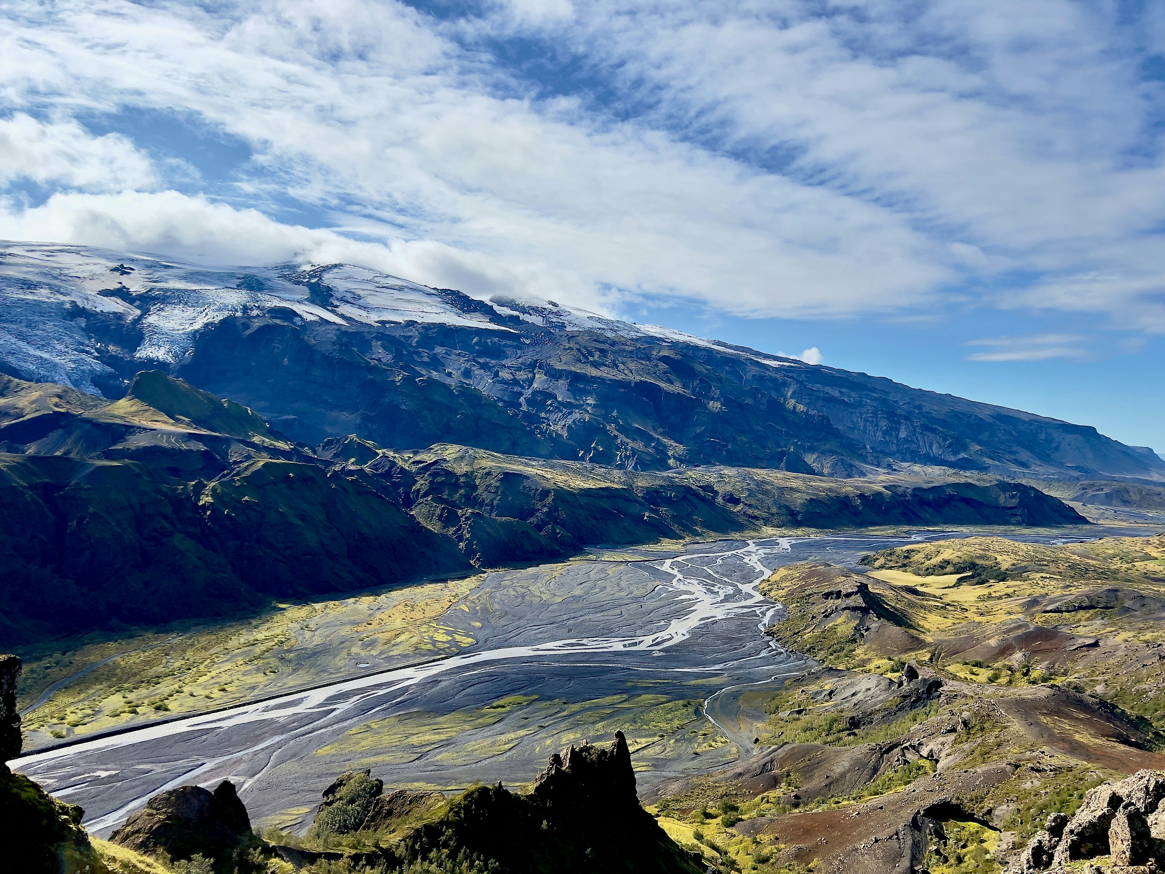
Fimmvörðuháls is one of the most dramatic day hikes in Iceland — and that is saying something in a country full of extraordinary landscapes. The trail crosses the high mountain pass between two of Iceland's most famous glaciers, Eyjafjallajökull and Mýrdalsjökull, passing through lava fields formed during the 2010 volcanic eruption that grounded flights across Europe. On a clear day, the views stretch from the South Coast all the way to the Westman Islands out at sea.
It is not an easy walk. But for hikers who are reasonably fit and properly prepared, it is one of the strongest day hikes in Iceland: waterfalls, black volcanic ridges, fresh lava from the 2010 eruption, glaciers on both sides, and a final descent into Þórsmörk.
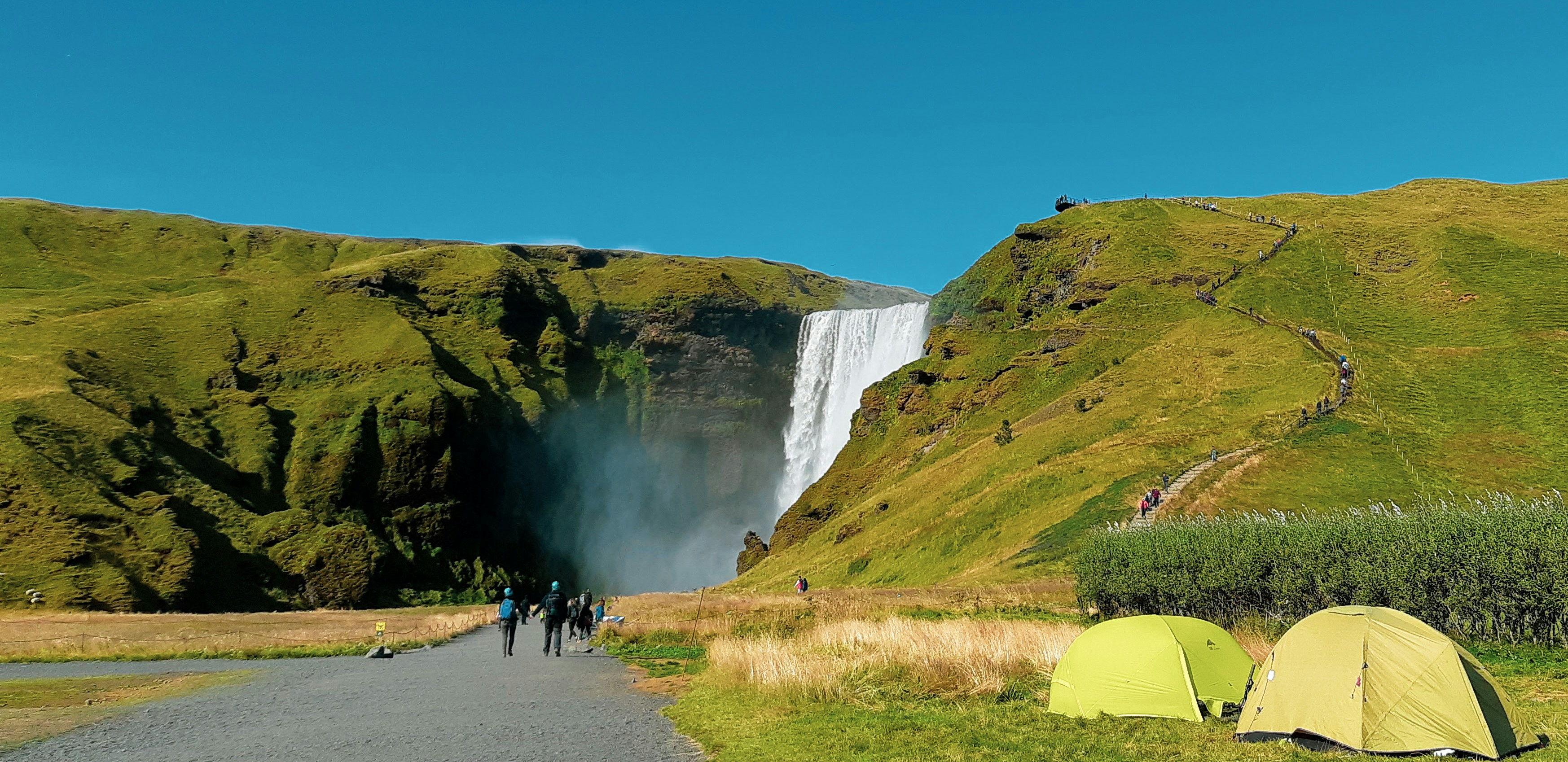
Most people hike from Skógar in the south — starting at the famous Skógafoss waterfall — up to the mountain hut at Fimmvörðuháls, then down into the valley of Þórsmörk. You either return by bus or arrange transport from both ends. Very few people do it as an out-and-back. If you are building a wider route around this area, pair this with the South Coast Iceland guide.
Quick Planning Links
Use these before committing to the hike, especially if Fimmvörðuháls is only one part of a larger Iceland itinerary.
The Route
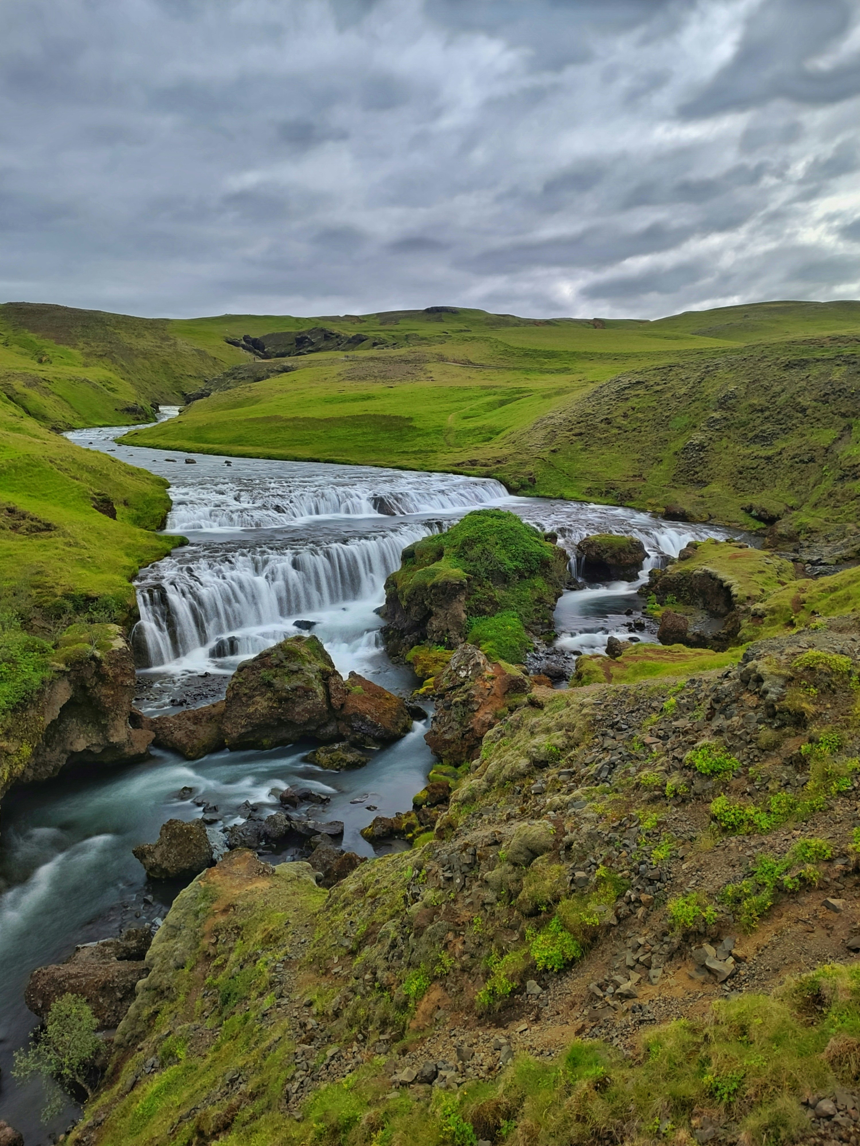
The classic direction is south to north — starting at Skógar and finishing in Þórsmörk. This makes the most of the dramatic ascent alongside the waterfalls from the south, and the descent into the lush green valley of Þórsmörk at the end.
Practical Information
If you would rather do this with a guide — strongly recommended in shoulder season or for first-time Icelandic hikers — there are reputable operators that run the trail with experienced guides and arranged transport. See guided Fimmvörðuháls hikes →
Getting to the trailhead
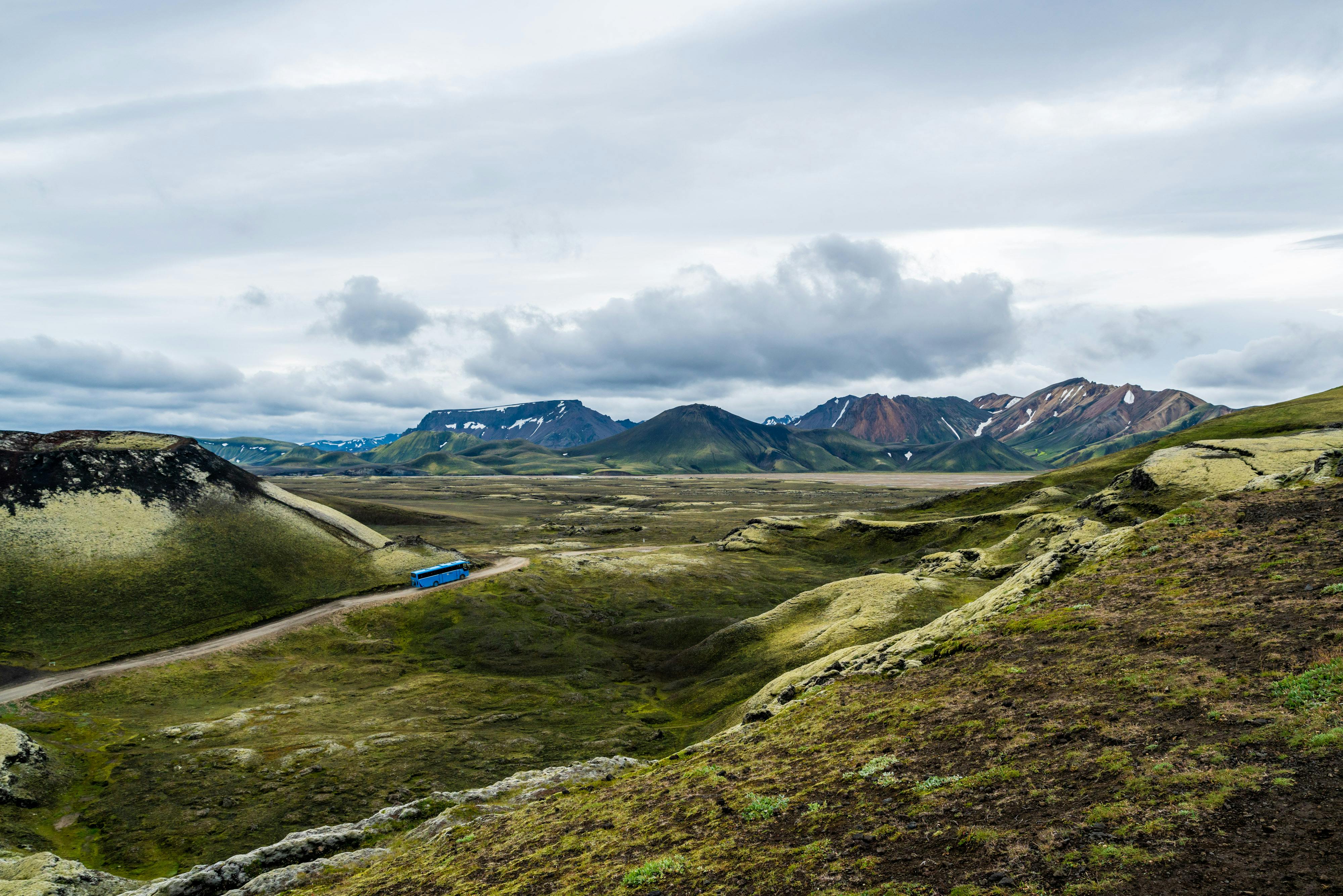
Skógar is about 150 km east of Reykjavík along the Ring Road — roughly a two-hour drive. There is no public bus that goes directly to Skógar from Reykjavík in time for an early start, so most people either drive or join an organised hiking tour. From Þórsmörk you can take a highland bus back in summer. The route crosses rivers and requires specialised vehicles. Do not try to drive a normal rental car into Þórsmörk; our car rental guide explains why Icelandic highland access and insurance rules matter.
The mountain hut at Fimmvörðuháls
Roughly halfway along the trail, at the highest point of the pass, sits a small mountain hut run by Ferðafélag Íslands (the Icelandic Touring Association). It sleeps around 27 people and has basic facilities — sleeping bag accommodation, a small kitchen, and a toilet. Booking in advance is essential in summer. Many hikers split the route across two days, staying overnight here and descending to Þórsmörk the following morning.
Splitting the hike over two days is highly recommended if you are not an experienced hiker. Day one: Skógar to the mountain hut (around 5–6 hours). Day two: the hut to Þórsmörk (around 4–5 hours). This lets you enjoy the lava fields and the descent in daylight without rushing.
What to wear and bring
The weather on Fimmvörðuháls is unpredictable even in midsummer. The trail crosses exposed terrain above 1,000 metres where wind, rain, and even light snow are possible at any time of year. You need proper waterproof hiking gear, including waterproof trousers. Hiking poles are strongly recommended for the steep descent into Þórsmörk. For a wider clothing checklist, use the Iceland packing list.
- Waterproof jacket and trousers
- Warm mid-layer (fleece or down jacket)
- Sturdy waterproof hiking boots with ankle support
- Hiking poles
- At least 2–3 litres of water (you can refill from streams on the trail)
- High-energy snacks and lunch — there is nowhere to buy food on the trail
- Sunscreen and sunglasses (the snow reflects UV strongly)
- Headlamp (in case you run late)
- Map or downloaded offline GPS track
Fimmvörðuháls is regularly attempted by people who are not properly prepared. The trail is long, exposed, and the weather can turn dangerous quickly. Check the Icelandic Met Office forecast (vedur.is) the morning of your hike. If the forecast shows strong winds or poor visibility on the mountain, postpone. No view is worth risking your safety.
Best Time to Go
The trail is typically accessible from late June through to the end of September. Before June, the high section is usually covered in deep snow and the route requires crampons and experience with winter mountain travel. July and August are the most popular months — the weather is most stable, the days are longest, and the midnight sun means you have effectively unlimited daylight. September is quieter and the autumn colours in Þórsmörk are extraordinary, but the weather becomes less reliable. For the wider seasonal picture, read the best time to visit Iceland guide.
Avoid attempting Fimmvörðuháls in winter unless you are an experienced mountaineer with full winter gear. People have gotten into serious trouble on this trail in bad conditions.
Combine it with Laugavegur
Fimmvörðuháls is often hiked as the final section of the famous Laugavegur trail — a four to five day trek from Landmannalaugar to Þórsmörk. If you have the time, adding Fimmvörðuháls as a fifth day and finishing at Skógar makes for one of the great long-distance hikes in the world. The combination is increasingly popular and considered by many to be the finest multi-day hiking route in Europe.
Fimmvörðuháls FAQ
How hard is the Fimmvörðuháls hike?
It is challenging. The route is around 25 km with a long climb, exposed high ground, possible snow patches, fast-changing weather and a steep descent into Þórsmörk. Fit hikers can do it in one long day, but it is not a casual waterfall walk.
When is the best time to hike Fimmvörðuháls?
Late June to September is the normal season. July and August usually offer the best combination of daylight, trail access and transport options. September can be beautiful and quieter, but weather becomes less reliable.
Can you drive a normal rental car to Þórsmörk?
No. Þórsmörk access involves highland roads and river crossings. Use a highland bus, proper super jeep transfer or organised tour. A normal rental car is not suitable, and attempting river crossings can void insurance.
Do you need a guide for Fimmvörðuháls?
Experienced hikers can do it independently in good summer conditions with proper gear, navigation and transport sorted. A guide is sensible in shoulder season, poor visibility, uncertain weather or if you are not used to Icelandic mountain routes.
The Bottom Line
Fimmvörðuháls rewards effort in a way that few hikes anywhere can match. The combination of waterfalls, glaciers, fresh lava fields, and the descent into the green valley of Þórsmörk packs more landscape variety into a single day than most people see in a week of hiking elsewhere. Go prepared, check the weather, and give yourself enough time to enjoy it. This is Iceland at its most elemental.